


Hiiker offers a sensible balance between community/inspiration features and standalone functionality for map viewing and plotting your own routes. It also has a relatively simple and easy-to-understand interface. I like the fact that route discovery and the main map screen are split into separate views – you get a nice clean map when you don’t want to have recommended routes displayed as well.
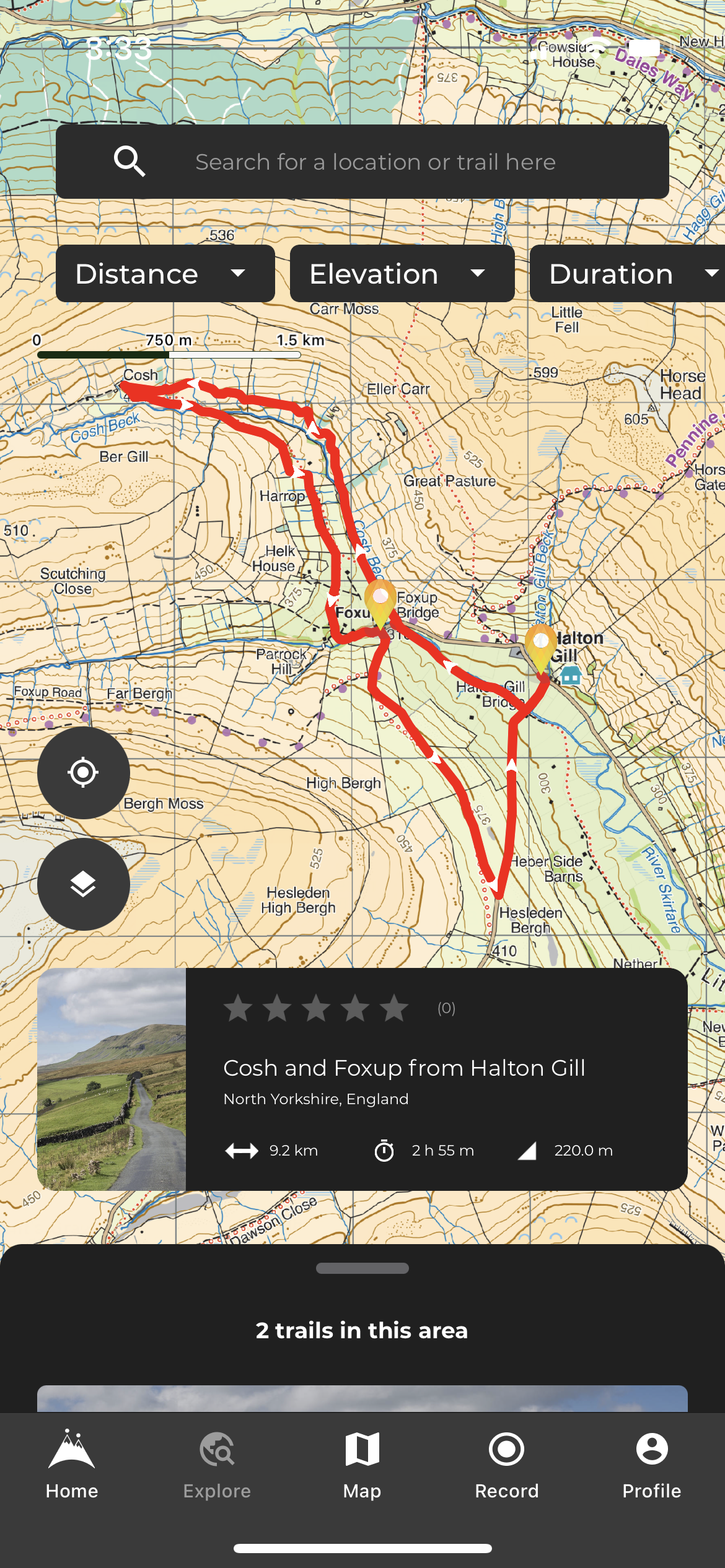
The app’s “Home” tab gives a list of nearby trails, along with other curated lists of walks. You also get hiking stories and tips. Trails are listed with all of the required information, such as distance, duration, elevation gain, a brief description, and pictures. You can download maps for the route or export a GPX file from this page.
There is also an option to download a print map (built-in routes only). This splits longer walks into day stages and then generates a PDF with a map for each day. Although you can only print out OSM maps, not OS maps, and you can’t control the length of the stages or how much appears on each page, this is a good easy option for carrying a paper backup on a multi-day walk.
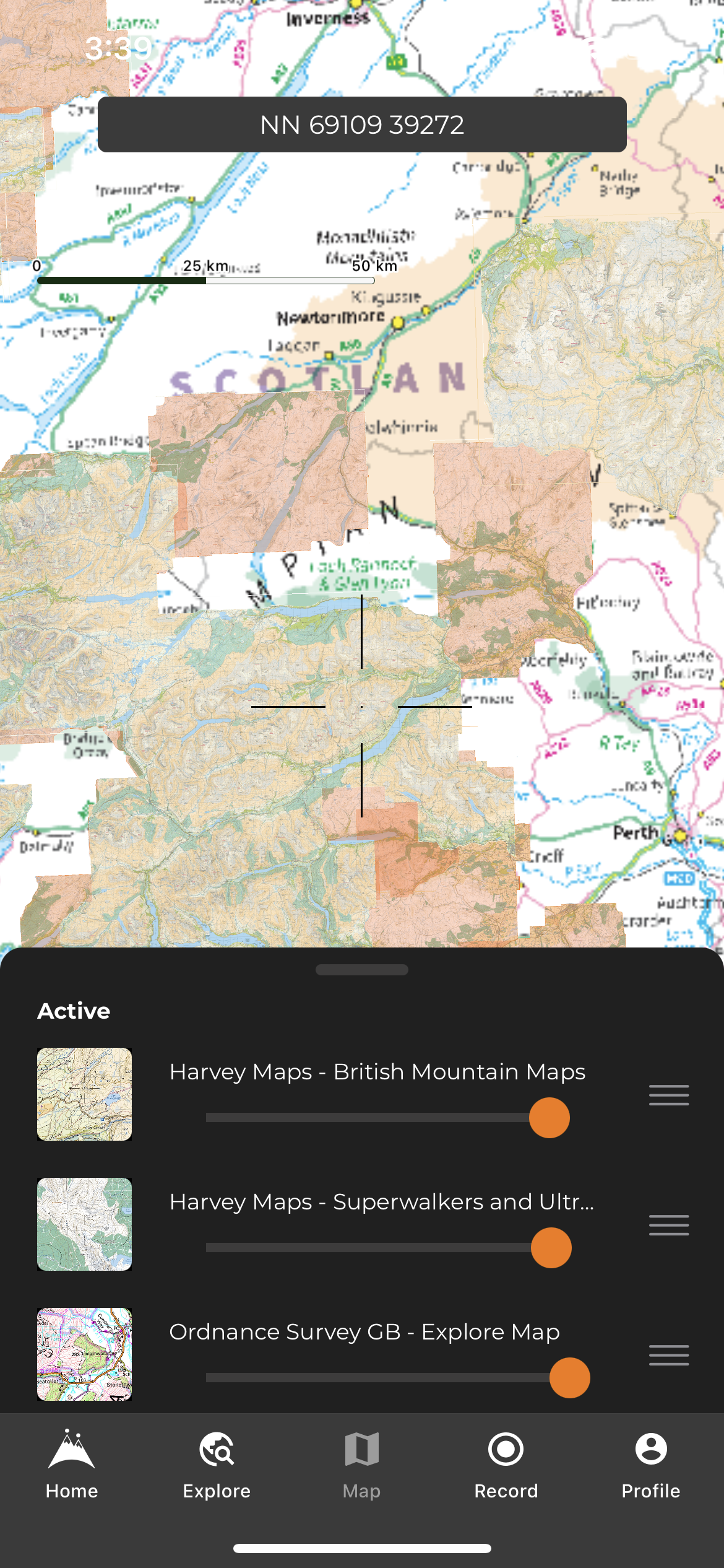
To download maps for offline use, you can either do it for a particular route or via a rectangular area on the map screen. Little fine-grained control of downloads is possible, but it will be sufficient for most people. And Hiiker has made offline map downloads free for all users, which is a good move. You still only get detailed topo maps if you pay for Pro+, though.
The “Explore” tab gives you a more powerful way to search for nearby routes, although they are not shown directly on the map – you just get a pin to show you that a trail is there and can’t see the route itself until you tap through to it. This could be presented more clearly.
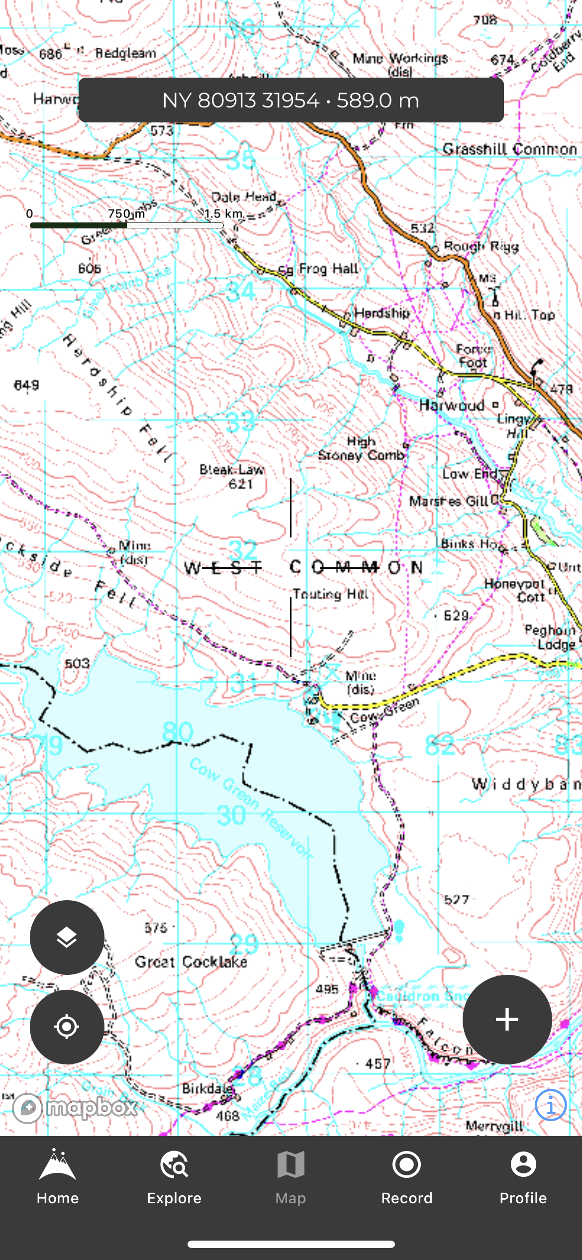
The main map tab is clear and has a minimal interface: OS grid reference with elevation at the top, buttons at the bottom for map layers, GPS location, and “+” – which you can use for planning routes, importing files or downloading map areas. The layers function is powerful. You can show many different map types on the screen at once and control their order and opacity. For example, if you place Harvey maps above an OS maps layer, OS maps will be displayed for everywhere in the country except places that have Harvey maps – which will show the relevant Harvey map instead.
OS maps are somewhat grainy and with slightly strange colours. I contacted Hiiker about this, and they said “There are some rendering issues with colours that we’re still trying to figure out. We are talking to OS to see what can be done about it.” Harvey maps are much clearer and look perfect.
Route planning makes use of both snap to path (which can be turned off when you want) and direct routing. However, although the app will let you plan in the direct-routing method without an internet connection, you can’t actually save a route if you’re offline. In every other respect the route-plotting experience is fantastic, though – you get a clear presentation of distance, ascent, descent, expected time, and even an elevation profile right there. GPX export is easy but importing a GPX file is clunky, and you can’t just share a route from another app to Hiiker on iOS.
Unfortunately, you can’t view your own planned routes on the main map. To view a route on a map, you have to either “track this trail” (follow the route while recording a new track) or tap through to “view map” – an entirely separate screen. This is clunky and doesn’t work for users who would prefer to see all (or a subset) of their routes on a single map screen for quick reference.
With a generally clean interface and a good balance of features, including Harvey maps, Hiiker has everything that most walkers will need. However, image quality of OS maps could be better, and power users may look for more offline support and the ability to show their routes on the main map screen.
See more hiking apps in or guide to the Best hiking apps for digital mapping
