


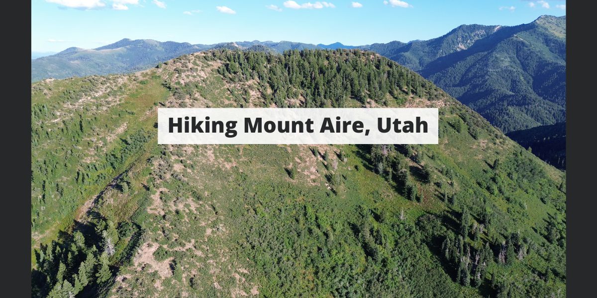
Mount Aire is a common hike for locals due to its close proximity and stunning views. Hikers can access trails off of I-80, or from Millcreek Canyon. In this article, we will discuss everything you need to know to hike this mountain from any trailhead.
Distance – 3.24 miles round trip (5.2 km)
Height – 8,602 feet (2621.9 m)
Elevation gain – 1,869 feet (569.7 meters)
Duration – 3-4 hours
Difficulty – Difficult
Hike Class: Class 2 hiking
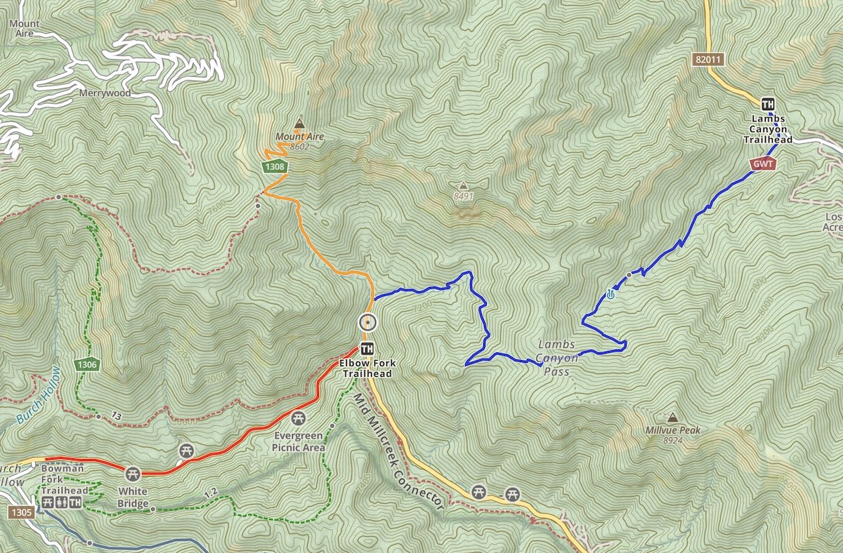
Trailhead Locations – Elbow Fork Trailhead | Lambs Canyon Trailhead (Directions Below)
Quick Navigation:
Routes | Trail Map | Lodging Info | Weather | Directions | Pictures
Here is the information associated with the two options for reaching the summit.
This is the most common trailhead to the summit as it is the quickest approach and has the least amount of elevation gain. It is well marked, easy to follow, and accessed from Millcreek Canyon.
We have created a full GPX file and map of this route for you: Elbow Fork Trailhead Map & GPX File
This is a longer approach that features elevation gain, then elevation loss, and then a gain once again to summit. It therefore is a lot more difficult than the Millcreek side. For that reason, it isn’t the recommended approach if you are looking for the easiest way to summit. The trail is well marked and easy to follow.
We have created a full GPX file and map of this route for you: Lambs Canyon Trailhead Map & GPX File
There is avalanche danger in winter, so it is important for hikers or skiers to have the proper gear and knowledge before summitting this peak while snow is on the ground.
In addition, the Millcreek Canyon side has a road closure in winter adding to the length. You can see a GPX file we created from the parking lot at the closed gate during winter months: Mount Aire Winter GPX
We have created an online map and GPX file for each of the trail options listed above. You can use those links to view an online map of Mount Aire as well.
There are several campground options in Millcreek canyon.
Here is the detailed weather forecast for the next few days. We highly recommend you check out local weather the morning of your hike.
Tonight
A chance of showers and thunderstorms before 9pm, then a chance of showers and thunderstorms. Mostly cloudy. Low around 55, with temperatures rising to around 57 overnight. South wind 7 to 10 mph. Chance of precipitation is 40%.
Sunday
Showers and thunderstorms likely. Mostly cloudy. High near 71, with temperatures falling to around 69 in the afternoon. South southwest wind 6 to 15 mph. Chance of precipitation is 70%.
Sunday Night
Showers and thunderstorms. Cloudy. Low around 47, with temperatures rising to around 50 overnight. South southwest wind 8 to 15 mph. Chance of precipitation is 90%.
Labor Day
Showers and thunderstorms before noon, then a chance of showers and thunderstorms. Mostly cloudy, with a high near 56. West southwest wind 8 to 13 mph. Chance of precipitation is 80%.
Monday Night
A slight chance of showers and thunderstorms before midnight. Partly cloudy, with a low around 46. Southwest wind 5 to 10 mph. Chance of precipitation is 20%.
Tuesday
A slight chance of rain showers before noon, then a slight chance of showers and thunderstorms. Mostly sunny, with a high near 64. Chance of precipitation is 20%.
Tuesday Night
Mostly clear, with a low around 49.
Directions to Elbow Fork Trailhead:
Directions To Lambs Canyon Trailhead:
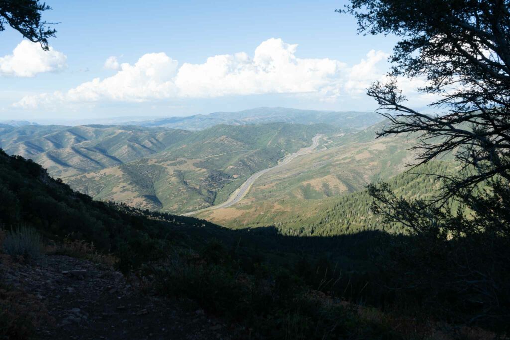
I-80 From near the summit of Mount Aire
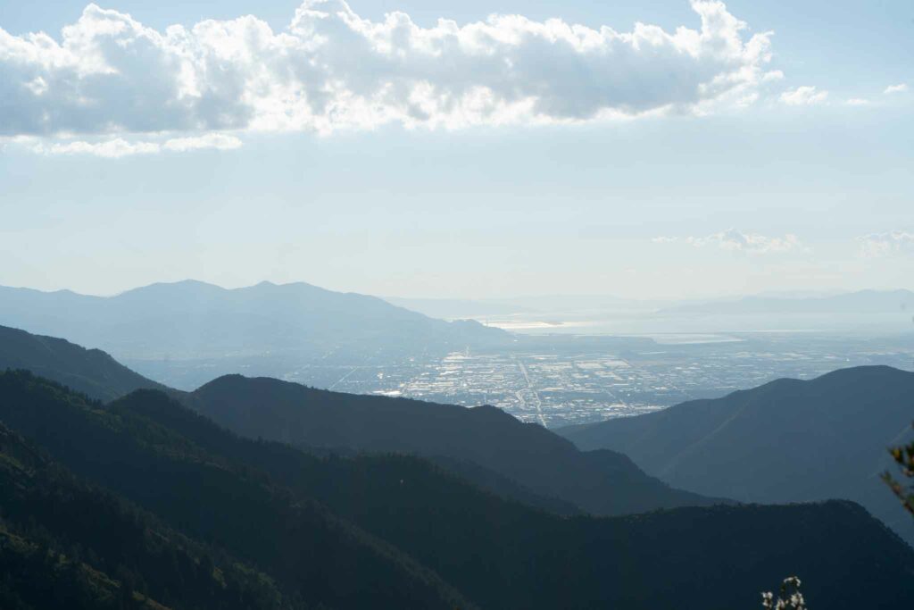
Salt Lake from Mount Aire
