


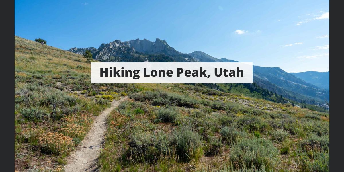
The majestic Lone Peak. Standing tall as the crown jewel of the Wasatch Range, this iconic summit beckons hikers with its awe-inspiring cliffs, views, and difficult trail. Here’s everything you need to know
Distance – 15.2 miles round trip (24.5 km)
Height –11,260 feet (3,430 m)
Elevation gain – 6,029 feet (1837.6 meters)
Duration – 10-11 hours
Difficulty – Difficuly
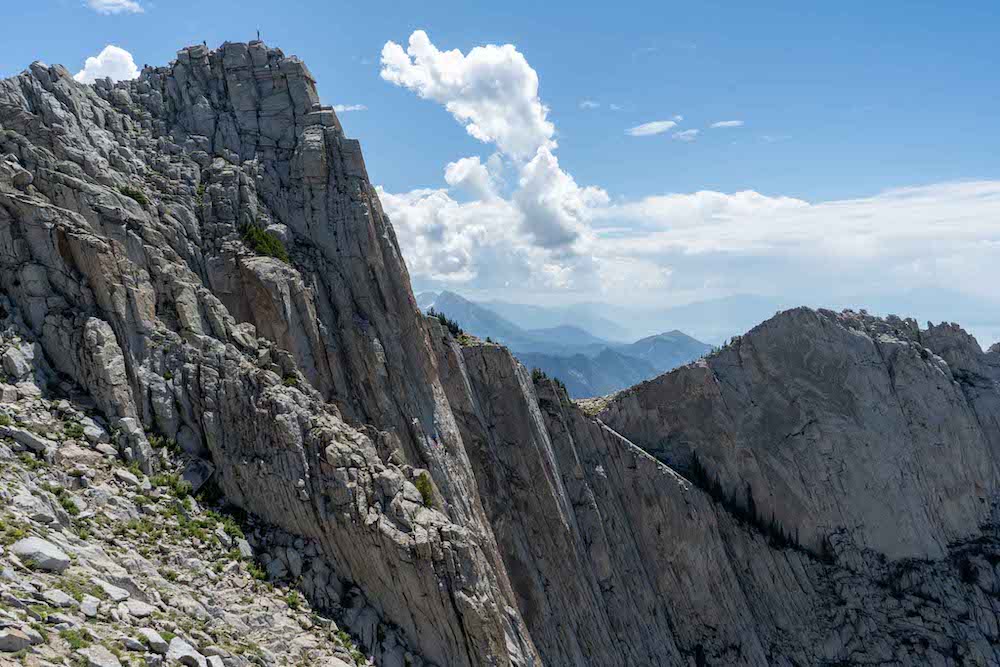
Hike Class: Class 4 hiking
Trailhead Locations – Peak View Trailhead | Jacob’s Ladder / Ghost Falls Trailhead | Orson Park and Trailhead (Directions Below)
Quick Navigation:
Routes | Trail Map | Lodging Info | Weather | Directions | Pictures
There are various route options, all of which are strenuous. Here is the information associated with each.
This is our recommended trailhead for most people due to the large parking area, the accessibility for any vehicle, and a well maintained trail to follow just about the entire way. It involves making the correct turns, particularly near the trailhead around many biking and hiking trails.
This option is one of the longer mileage options, but is the second shortest option in terms of elevation gain.
We have created a full GPX file and map of this route for you: Peak View Trailhead Map & GPX File
This is our recommended trailhead for those with high clearance vehicles that are willing to drive on a dirt road for a slightly shorter option. It is commonly called Jacob’s Ladder Trailhead, but is also called the Ghost Falls Trailhead.
This option is the quickest option for most given the mileage and elevation gain. This trailhead requires driving on a dirt road for a couple miles.
We have created a full GPX file and map of this route for you: Jacob’s Ladder / Ghost Falls Trailhead Map & GPX File
This is not the recommended trailhead for the first time given its extremely significant elevation gain of above 7,000 feet.
This is a stunning and gorgeous option for many however, and if you are up for the extra vertical gain, go for it!
We have created a full GPX file and map of this route for you: Bear Canyon / Orson Smith Park and Trail Trailhead Map & GPX File
The above three options are just the most common starting points. There are various trailheads that hikers can start from. Most of those meet up with the trails discussed in the above options at various points. You are welcome to hike from those other spots, just do a little bit of research before you do so, and consult a map to make sure you know your way.
This hike is not hiked frequently in winter due to avalanche danger, and lots of steep cliffs and drop offs that can be deadly with a fall. Do not attempt to summit without the proper equipment, experience, and knowledge.
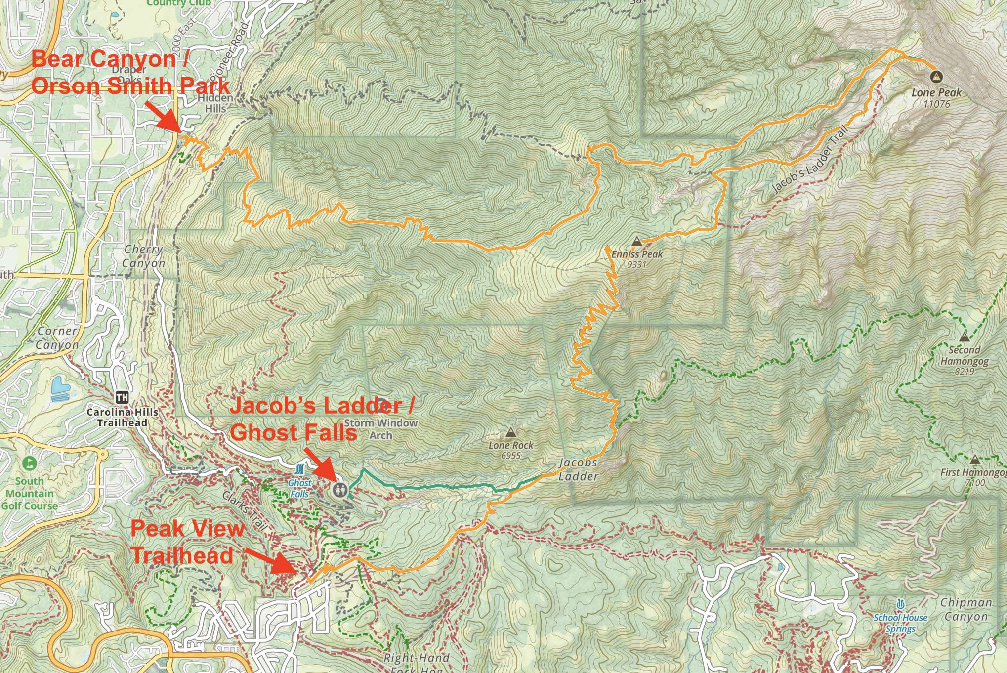
We have created an online map and GPX file for each of the trail options listed above. You can use those links to view an online map of Lone Peak as well.
This hike is located in close proximity to the towns of Draper and Alpine where there is plenty of lodging. In addition, hikers enter a Wilderness area with tons of dispersed camping options within the Wilderness. You can read about rules and regulations of the Lone Peak Wilderness Here. The most common area for camping is the Lone Peak Cirque that sits just short of the summit in a beautiful basin.
Here is the detailed weather forecast for the next few days. We highly recommend you check out local weather the morning of your hike.
Directions to Peak View Trailhead:
Directions To Jacob’s Ladder / Ghost Falls Trailhead:
Directions to Bear Canyon / Orson Smith Park and Trailhead:
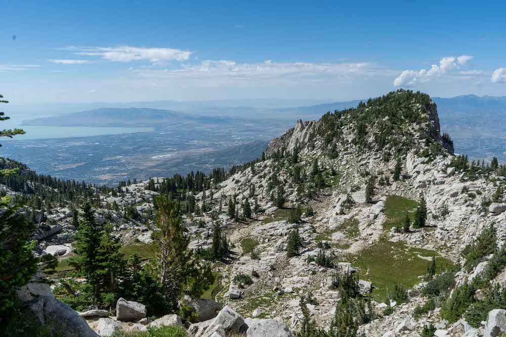
Views of the summit form the ridge
Views looking back at Peak View : Jacob’s Ladder Trailhead
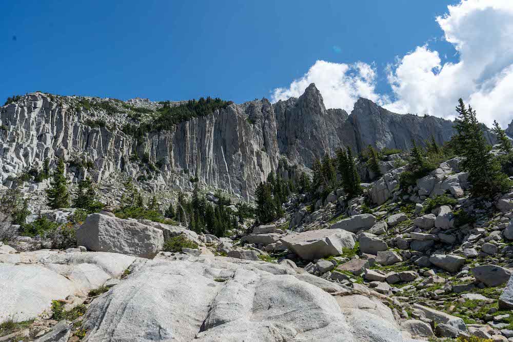
The summit from the basin below
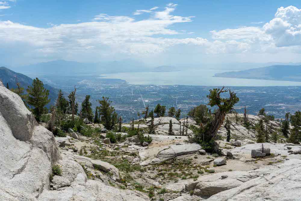
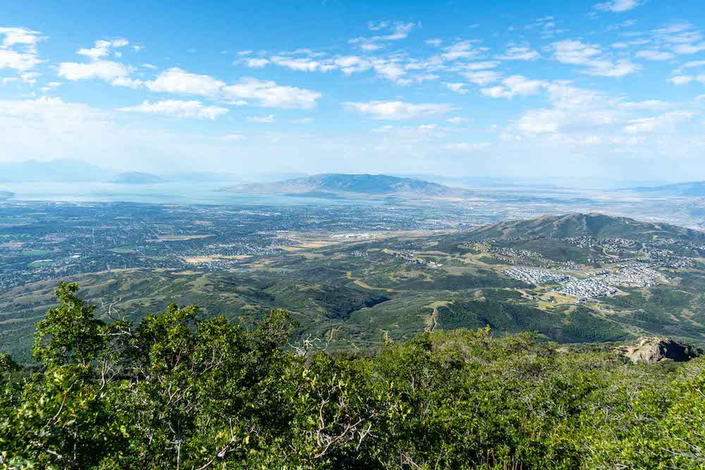
Views of Utah Lake
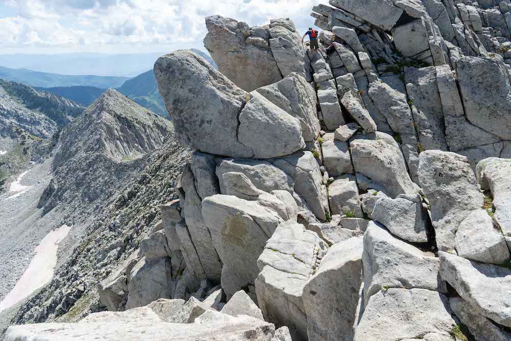
Beginning of class 4 section near the sumit
Views from atop the first steep climbing section
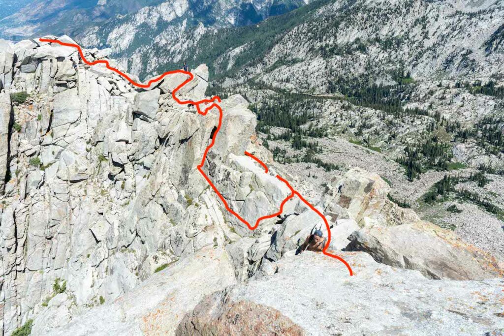
Looking at the class 4 section of the hike
