


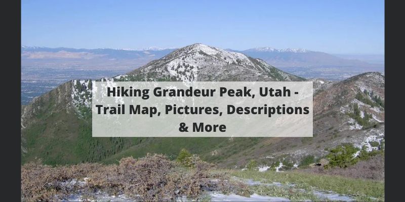
Grandeur Peak is a gorgeous and easy to access hike that looms over Salt Lake City. There are a couple common hiking routes to the summit, and in this article, we will cover everything you need to know.
Quick Navigation:
Trail Map | Trails | Hiking In Winter | Camping | Weather | Directions | Pictures
Difficulty – Intermediate
Distance – 5.52 miles round trip (8.88 km)
Height – 8,299 feet (2529.54 m)
Elevation gain – 2,403 feet (732.43 m)
Duration – 3-4 hours (book time)
Trailhead Location – Church Fork Picnic Area Trailhead (5,926 Feet) or Grandeur Peak Trailhead (AKA West Ridge Trailhead) (4,933 Feet)
Dogs – Allowed on this trail.
Here is some of our drone footage highlighting the incredible views from this awesome hike:
Click to enlarge
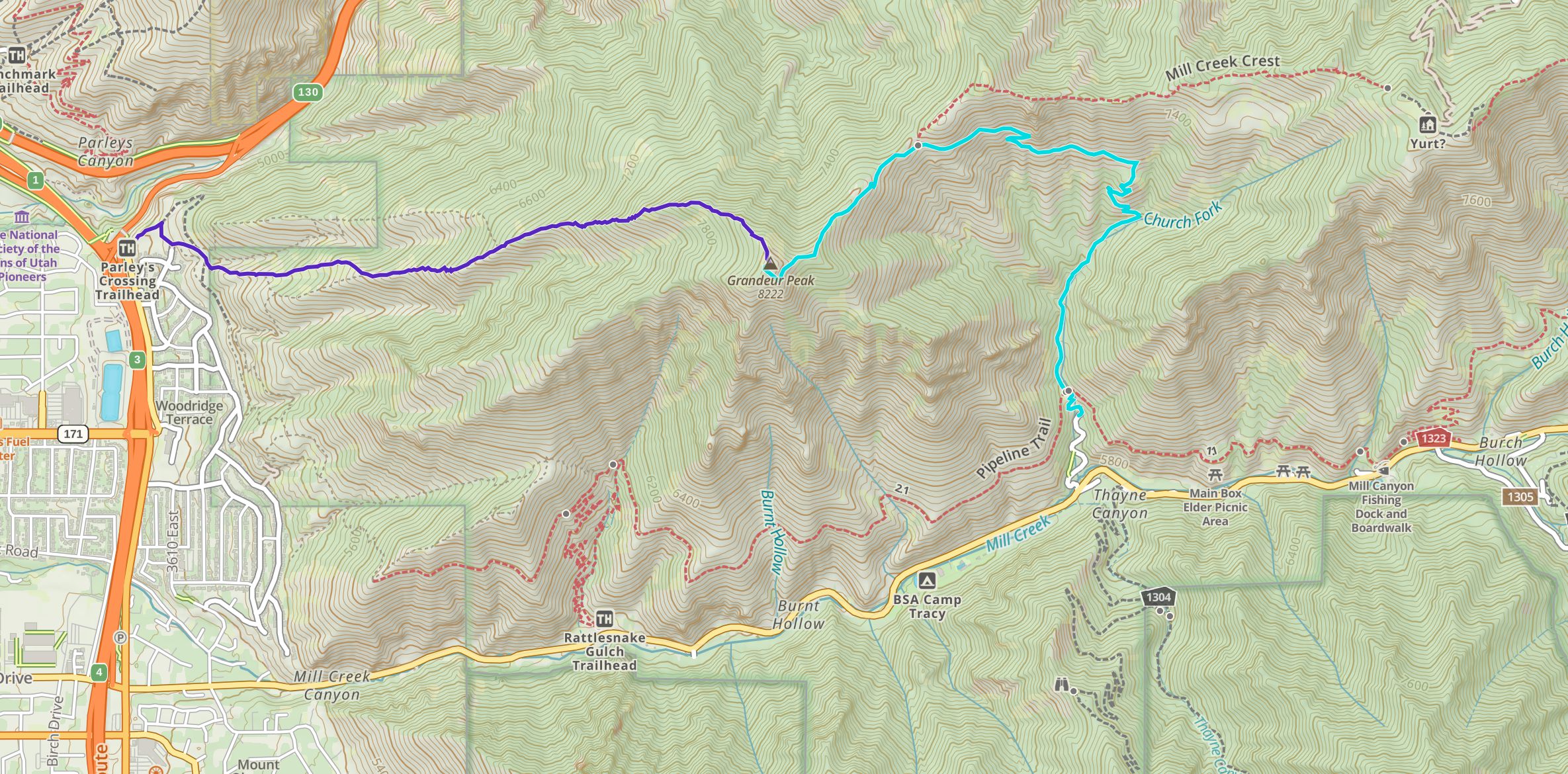
Download GPX For Church Fork Trailhead Here
Download GPX For Grandeur Peak Trailhead Here
This is the most common route to the summit of Grandeur due to the higher elevation starting point, and the fact that the trailhead is located at a very popular picnic area in Millcreek Canyon. This route does require paying an entrance fee for the Canyon. You can read about this below.
This trail is very well traveled, very well maintained, and very well marked, making it easy or anyone to follow. Hikers follow the signs and trail that follows a small creek and climbs gradually, and eventually relatively steeply through switchbacks.
This trail is slightly longer than via the West Ridge Trailhead, but has about 600 less feet of elevation gain, and a better trail, making it a much easier approach.
While this trail is shorter in distance, it is much steeper, and the trail is not as well maintained, making it a more difficult ascent than via Millcreek Canyon. There are actually several unmarked trails via ridges that head to the summit. All of about equal difficulty. Hikers simply take what appears to be the most traveled route, straight up the ridge all the way, and they will arrive at the summit.
This route is unforgiving and very steep, but is a blast as you have awesome views of Salt Lake City 100% of the trail. There is zero tree coverage, meaning hikers are exposed to sun, wind, and rain the entirety of the hike. On a hot day, this route is brutal.
If hikers want to do a loop, and experience both trails at once, there is a very feasible route with incredible views. By starting at the West Ridge Trailhead, hikers can ascend Grandeur Peak, drop down back into Millcreek Canyon, and turn onto the Pipeline Trail all the way to the stunning viewpoint at the mouth of Millcreek Canyon. At this point, the trail gets far less maintained, but is still easy to follow as it meanders along the west side of the mountains back to the starting point at the West Ridge Trailhead.
If you are interested in this route, we have created a GPX route of it here.
This is prone to avalanche conditions in winter and should only be done by those who are aware of current avalanche conditions, and are prepared for winter hiking. You can read the current avalanche forecasts on the Utah Avalanche Center website.
Only backcountry camping is allowed in the canyon. Camping must be at least 1/2 mile off the road, and 200 feet from any trails, water, or developed areas. More information can be found here.
Here is a detailed weather forecast for the area:
This Afternoon
Sunny, with a high near 81. West northwest wind around 9 mph.
Tonight
Mostly clear. Low around 61, with temperatures rising to around 63 overnight. East northeast wind around 8 mph.
Tuesday
Sunny, with a high near 86. South southeast wind 8 to 16 mph.
Tuesday Night
Mostly clear, with a low around 57. Southwest wind 6 to 17 mph.
Wednesday
Sunny, with a high near 78. West southwest wind 3 to 10 mph.
Wednesday Night
Clear, with a low around 56.
Thursday
Sunny, with a high near 80.
To Millcreek Canyon Trailhead at Church Fork:
To West Ridge Trailhead (Grandeur Peak Trailhead)
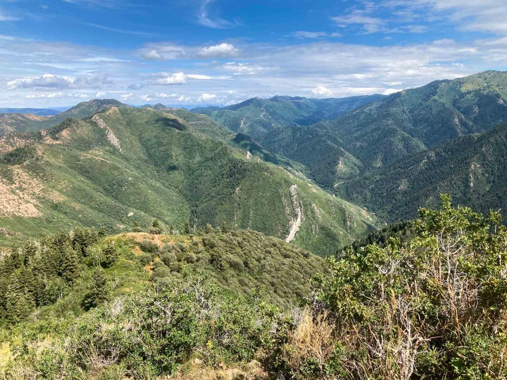
Grandeur Peak looking into Millcreek Canyon
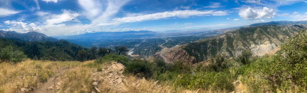
Pano from Grandeur Peak
