


Nestled amidst the serene waters of the Great Salt Lake, this iconic peak offers an exhilarating hiking experience that promises breathtaking vistas and even a chance to see bison. This article is your guide to successfully navigating the trails, embracing the challenges, and savoring the rewards that await atop Frary Peak, the highest point on Antelope Island.
Distance – 6.62 miles round trip (10.65 km)
Height – 6,581 feet (2005.9 m)
Elevation gain – 2,450 feet (746.8 meters)
Duration – 5-6 hours
Difficulty – Intermediate to difficult
Hike Class: Class 2 hiking
Trailhead Location – Frary Peak Trailhead, Antelope Island (Directions Below)
Quick Navigation:
Routes | Trail Map | Lodging Info | Weather | Directions | Pictures
There really is only one route up Frary Peak from a good sized parking lot. There is an overflow parking lot located down further that can be used if hikers want to add to the hike, or on a rare occasion, the parking lot was full.
Hikers begin at the parking lot which features a full trail map. There is only one trail leading out of the parking lot which has a few spur trails leading to very cool viewpoints. The most popular named point is Dooly Knob, which is a great alternative to Frary Peak if hikers are looking only for a short hike with great views. Simply put, hikers follow the Frary Peak Trail and the markings towards Frary Peak. The trail is well maintained, easy to follow, and gains elevation pretty steadily across the whole hike with exception to a few flatter portions, and a small descent between Stringham Peak and Frary Peak about 3.3 miles into the hike.
The trail between Stringham Peak and Frary peak is thin, and features a steep hillside just off of the trail. This is where caution should be taken, especially if the trail is wet or muddy.
Once passing this section of trail, the last portion to the summit is a bit steeper, but easy to follow.
This hike is accessible in winter, but traction in the form of microspikes should be brought due to icy conditions if ice is snow is present.

We have created an online map and GPX file you can download and see: View Frary Peak Hike Map and GPX File
This hike is located on Antelope Island, within the State Park. There are a few campgrounds you can take a look at here. The town of Syracuse sits just outside the island if you are looking for other types of lodging.
Here is the detailed weather forecast for the next few days. We highly recommend you check out local weather the morning of your hike.
Today
Sunny, with a high near 86. North wind 6 to 9 mph.
Tonight
Clear, with a low around 65. East wind 8 to 12 mph.
Tuesday
Sunny, with a high near 92. South southeast wind 10 to 15 mph.
Tuesday Night
Mostly clear, with a low around 62. West southwest wind around 17 mph.
Wednesday
Sunny, with a high near 80. North northwest wind 10 to 15 mph.
Wednesday Night
Mostly clear, with a low around 60.
Thursday
Sunny, with a high near 83.
Directions to Frary Peak Trailhead:
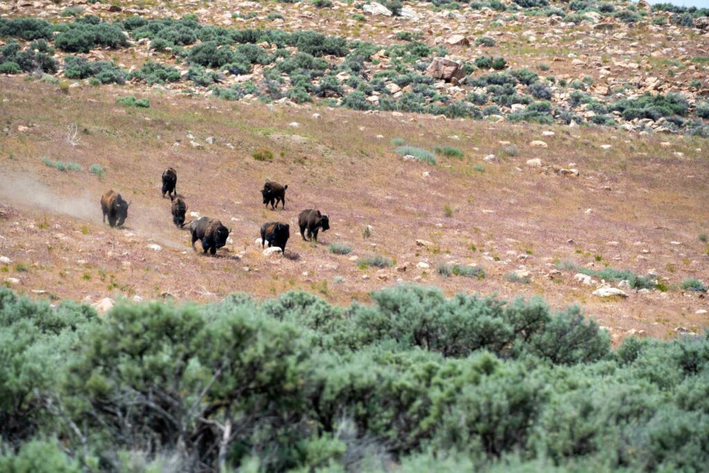
Bison on Antelope Island
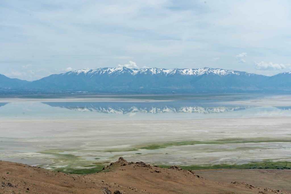
Reflection on the Great Salt Lake
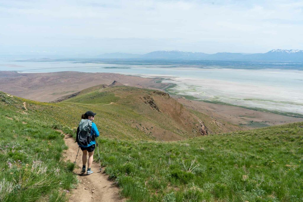
Trail looking at Dooly Knob in the distance
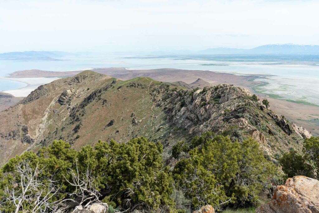
Views looking back at the trail from Frary Peak
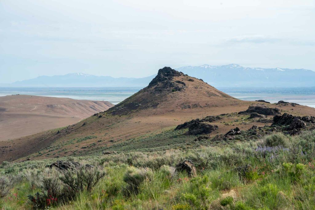
Dooly Knob
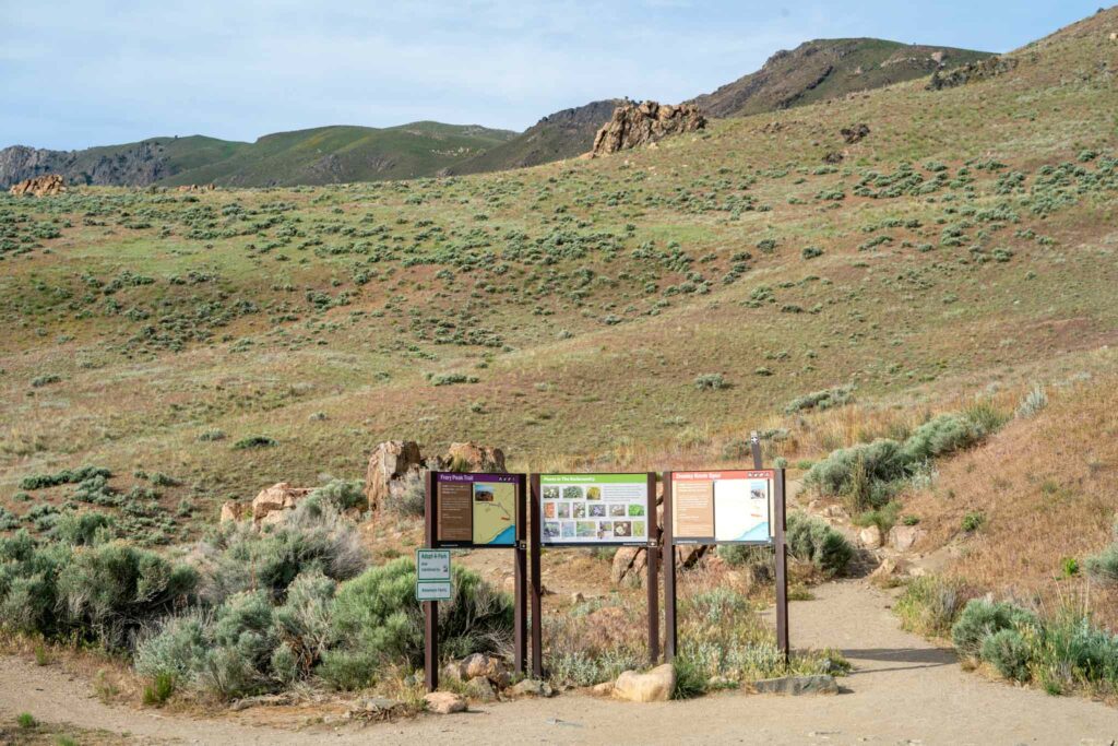
Frary Peak Trailhead
