


Devils Castle is located above Brighton Ski Resort in Big Cottonwood Canyon. It has a relatively straightforward option for hikers, as well as a technical ridge that will get your heart going (Devils Castle Traverse). Here’s everything you need to know about this peak. This is one of our favorite hikes in this area due to the fun scrambling, large cliff drop offs, and incredible 360 degree views.
Distance – 4.08 miles round trip (6.6 km)
Height – 10,850 feet (3307.1 m)
Elevation gain – 1,796 feet (547.4 meters)
Duration – 3.5 – 4 hours
Difficulty – Difficult
Hike Class: “Easy Route” is Class 2 hiking, ridge traverse is Class 5
Trailhead Locations – Cecret Lake Trailhead (other options below as well)
Quick Navigation:
Routes | Trail Map | Lodging Info | Weather | Directions | Pictures
For the adventure seekers that want to travel the ridgeline of Devils Castle, this is your route. We want to warn those afraid of heights, or without much scrambling experience, this route has a lot of exposure to big cliffs where falls would be fatal. The route is considered class 5.
9.9 miles round trip (15.9 km) – 3,933 feet (1198.8 meters)
Hikers begin at the Cecret Lake Trailhead but head towards the road as opposed to the trail to Cecret Lake. The road heads all the way up to Point Supreme. From point supreme, hikers simply follow as close to the ridge as possible. From the ridge, hikers start to experience class 3 scrambling at various points and need to find there way around rock spires, trees, loose dirt, and more. The going is relatively slow, the trail isn’t a maintained trail, but rout finding is easy as hikers are basically staying along the ridge, and following what often appears as the most traveled parts of the terrain around them.
Hikers will begin experiencing sections where using your hands are required, but most of this remains quite straightforward, even though some larger drops on either side become present.
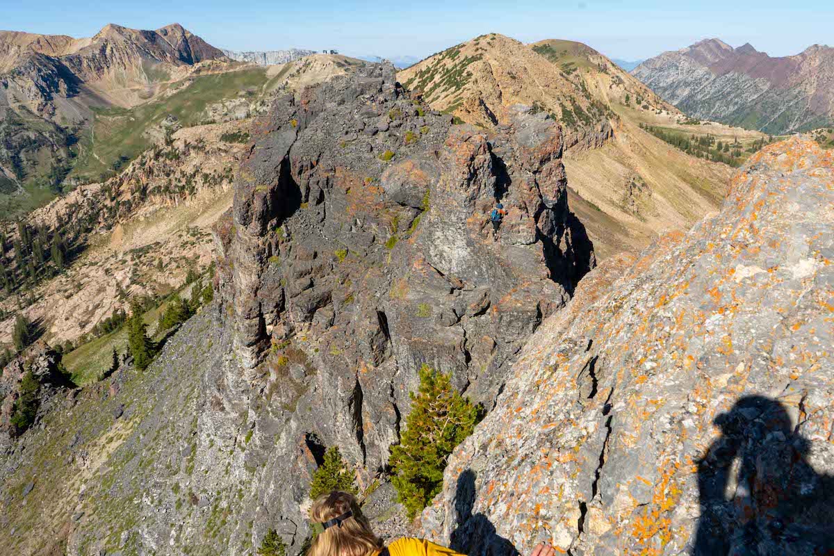
Quite simply, the ridge seems to progressively get more challenging and more beautiful. Areas cycle between easy walking and difficult scrambling before eventually hitting the most difficult parts of the trail. Hikers will be climbing up and over each of the major spires along the ridge. It looks terrifying from a distance, but does get a bit better when you are actually on the sections that look the scariest from the beginning. Images include here are to help you with route finding along the ridge.
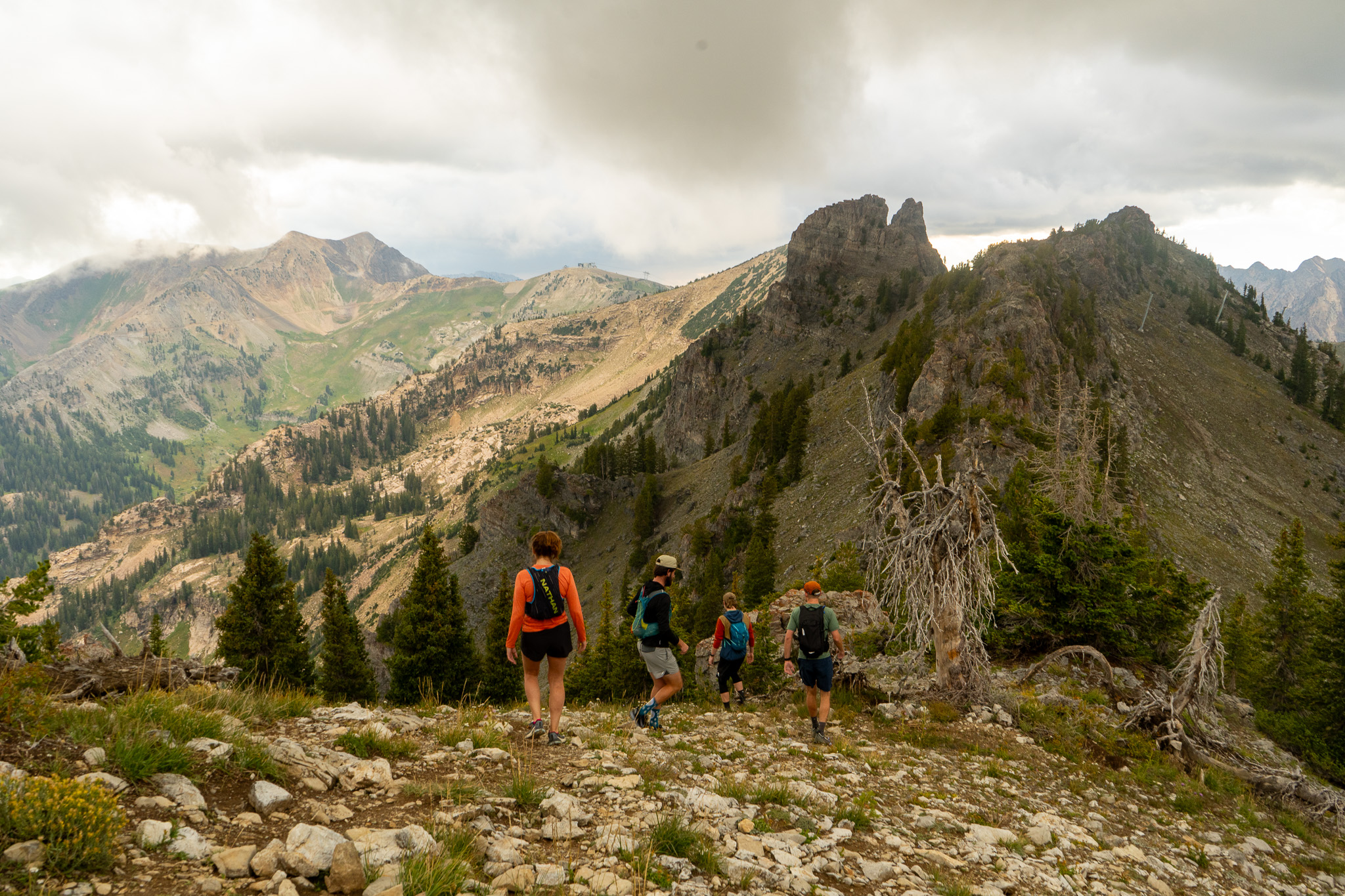
Views after point supreme looking towards the upcoming ridge where hiking gets more difficult.
Hiking along the ridge before getting to the main traverse features a lot of terrain like this.
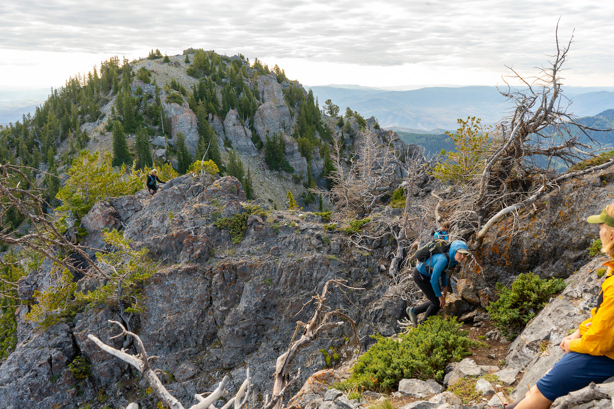
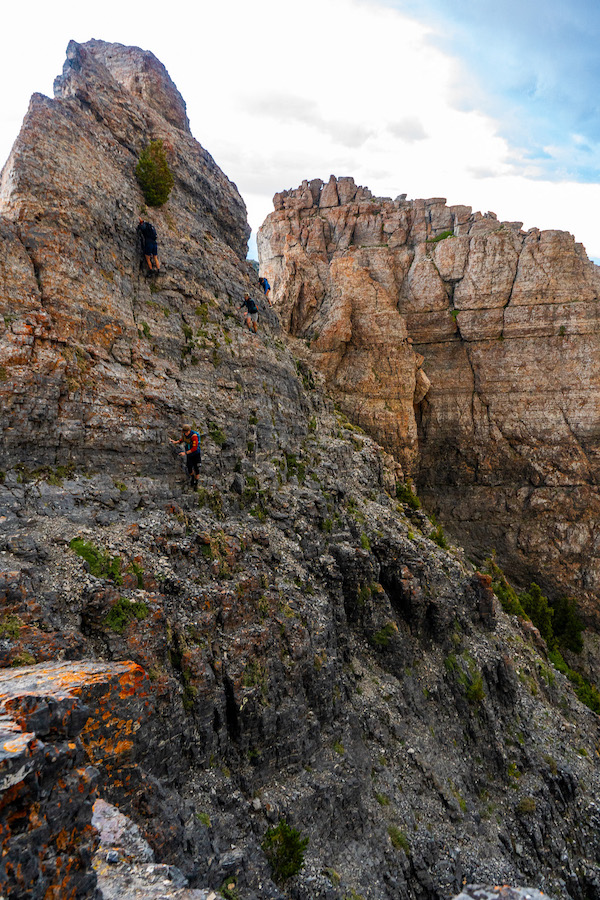
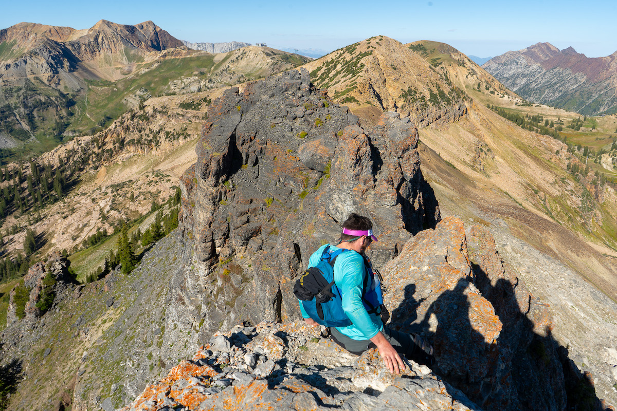
Standing atop the first spire along the Devils Castle traverse. The hike to the first spire is a lot simpler than it looks from the distance, but caution is needed for just about every step on this hike from this spire until getting off of the traverse.

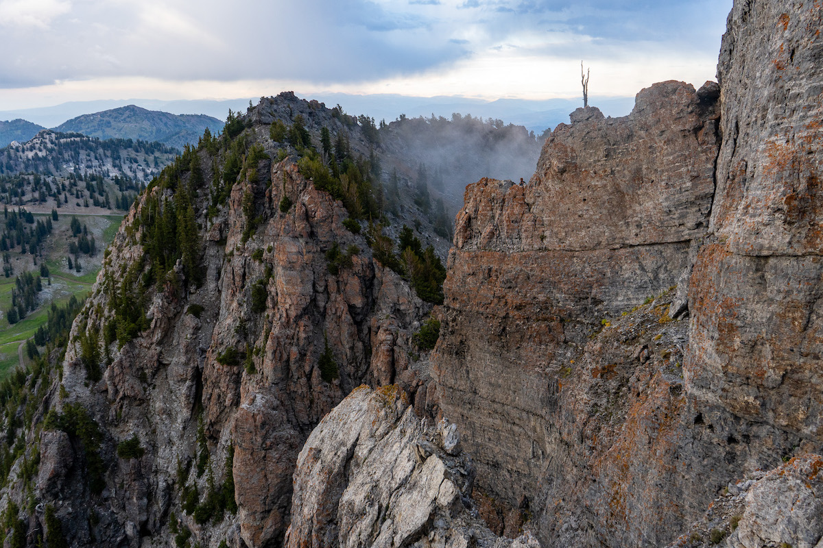
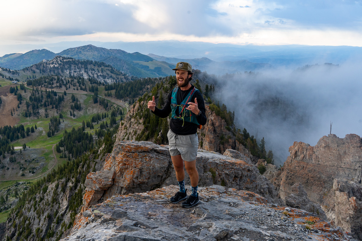
Epic views along the traverse
Incredible castle cliffs from a viewpoint between the first rock spire and the second rock spire.
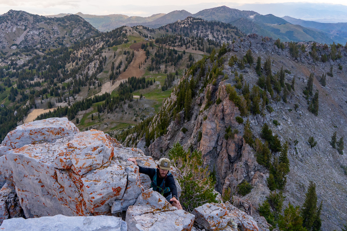
There are a few spots where different paths are possible, but some are clearly easier than others.
Excitement from friends along the ridge!
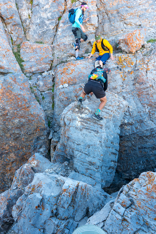
A funky but necessary move over a boulder along the traverse.
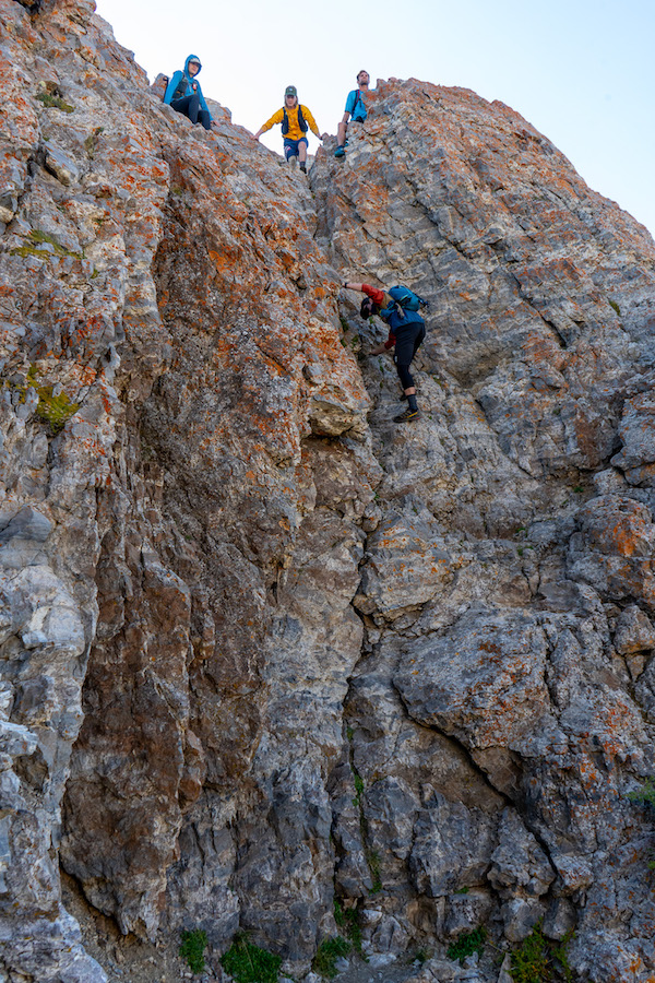
Down climbing section along the traverse. Hikers are exposed to a dangerous fall, but the terrain has great foot and hand holds for a slow and steady climb or descent.
Devils Castle Traverse near the summit.
Once hikers reach the final spire, the hike becomes a very straightforward hike. Hikers descend on the north side of the summit, dropping 20-30 feet before the trail cuts across to the south side of the ridge towards Sugarloaf Peak. From here, simply follow the obvious and well traveled trail back down to Cecret lake and out to the car.
4.08 miles round trip (6.6 km) – 1,796 feet (547.4 meters)
This route is far simpler than the traverse. Hikers have several options towards Cecret Lake, and they tak ethe trail that goes east of Cecret Lake and heads up to the saddle between Sugarloaf Mountain and Devils Castle. This is well traveled and easy to follow, but doesn’t have any trail signs leading the way. Often, hikers will take a small detour to Cecret Lake, or to Sugarloaf Mountain when combining this route.
Devils Castle is located above Brighton Ski Resort. This is not a winter hike, though there are those that ski off of portions of the mountain and nearby mountains.
We have created an online map of the easy route that doesn’t go along the traverse: Download The Route Here
We have created an online map of the traverse loop: Download The Route Here
You can also look at our trail map image here:
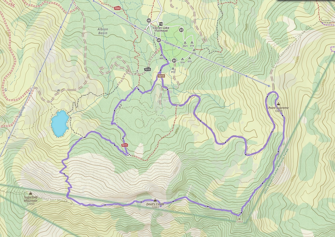
Devils Castle Trail Map
There are campgrounds within Albion Basin that can be reserved when they are open. This campground contains 24 camping sites, each with picnic tables and campfire rings. Vault toilets are also on the premise. Information and availability can be found here.
Cecret Lake does have fish in it. With our most recent trip, the lake was drained, and therefore we suspect fish have died. We will release more information when we know regarding when this lake will be fishable again. This is a catch and release fishery.
Here is the detailed weather forecast for the next few days. We highly recommend you check out local weather the morning of your hike.
The first trailhead is the lower trailhead that is free to park at. There is free parking along the main road, across the street, and in various locations. Parking is relatively easy, and marked, but the trailhead starts right behind the Alta Ski Shop. The most common trailhead is the Cecret Lake Trailhead which does require passing a gate, which is open on most weekdays and weekends. On these days purchasing a parking pass for the day can be done via the kiosk, or via a person managing the small building hut. Read the signs for any updates on the day you are there.
This is the Albion Base Trailhead:
The most common trailhead is the Cecret Lake Trailhead (usually requires purchasing day pass):
Hikers can also choose to park at the Catherine Pass Trailhead if they choose. This also requires a day pass. This trailhead is between the lower trailhead and the Cecret Lake Trailhead, and hikers can join the trail system from this parking lot:
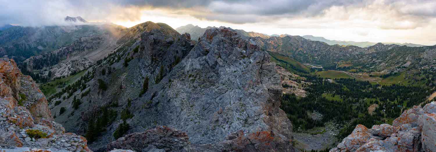
Panoramic views of the Devils Castle Traverse
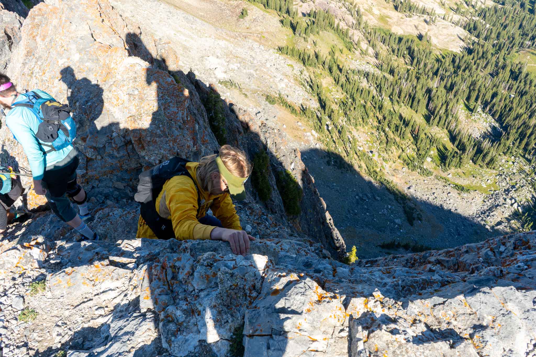
Downclimbing the traverse
Views of the traverse
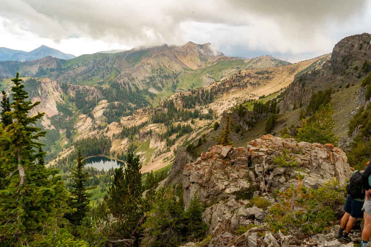
Views to the north of the traverse
