


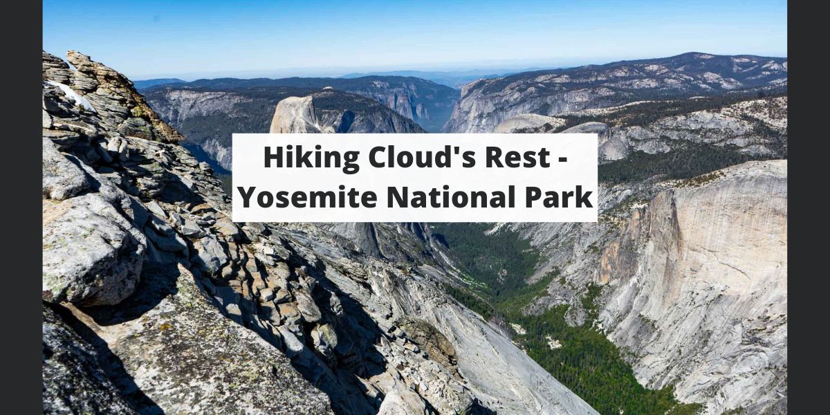
For those looking to take their Yosemite National Park adventure to the next level, hiking up to Clouds Rest is an absolute must. It features breathtaking 360-degree views, with Half Dome clear in site, this may be the best views in all of Yosemite National Park. In this article, we’ll cover everything you need to know before setting out on your Cloud’s Rest hike.
Quick Navigation:
Trail Map | Trails | Hiking In Winter | Camping | Directions | Pictures
Difficulty – Intermediate
Distance – 12.5 Miles Round Trip (20.12 km)
Height – 9,926 feet (2967.23 m)
Elevation gain – 3,100 feet (944.88 m)
Duration – 8-10 hours round trip
Hike Class: Class 2
Trailhead Location – Sunrise Lakes Trailhead (8,184)
Dogs – Not allowed
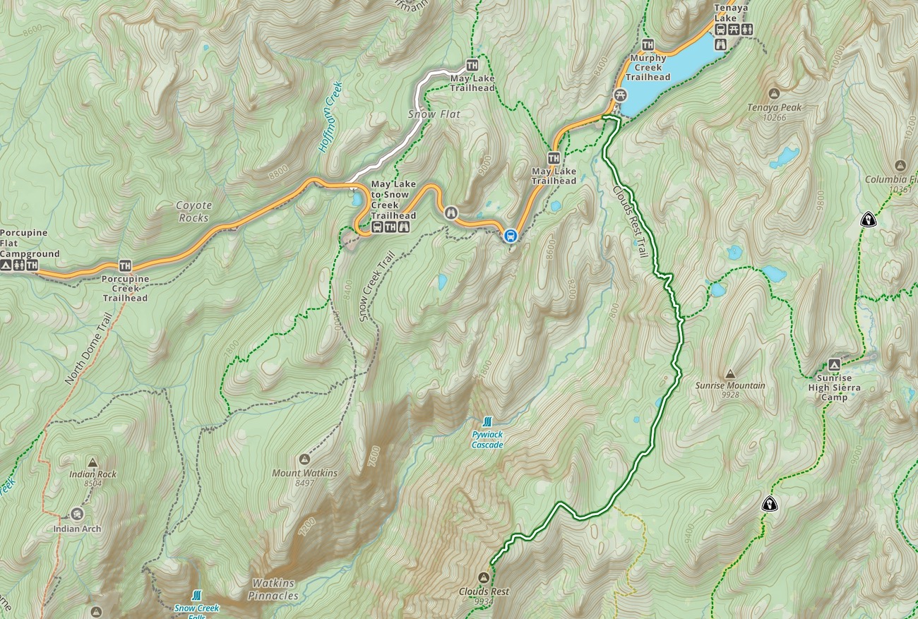
The main route to Clouds Rest is from Tioga Road, which is closed in winter often until late May or June. This route is significantly shorter than the alternative necessary when the road is closed from Yosemite Valley. Generally, this hike is only done from the valley as part of an overnight backpacking trip.
Distance – 12.5 Miles Round Trip (20.12 km)
Height – 9,926 feet (2967.23 m)
Elevation gain – 3,100 feet (944.88 m)
Duration – 8-10 hours round trip
Hikers begin at the trail by the bathrooms at the sunrise lake trailhead. They quickly hit a water crossing (Tenaya Creek) that has stone steps across the river, but often times, hikers will need to get their feet wet for this. Be prepared for that!
The trail is easy to follow, and well marked. The views along the way are pretty stellar and unique just about the entire time. This route requires both steep uphills and downhills in both directions.
Distance: 18.04 Miles Round Trip (29.61 km)
Elevation Gain: 7,223 Feet (2201.57 m)
This is not the recommended route due to the very long hike required for a single day. That being said, it can be done, or this is an amazingly awesome starting point, or end point for an overnight trip (if you get wilderness permits).
Hikers will pass the amazing Vernal and Nevada Falls. They will also pass Little Yosemite Valley Campground, which would be a great place to stay to turn this into a backpacking trip.
Refer to trail closures and winter hiking info here.
Nearby lodging and campground information can be found here.
And getting backcountry/wilderness camping permit info can be found here.
Here is a detailed weather forecast for the area:
This Afternoon
Mostly sunny, with a high near 21. Wind chill values as low as 8. West wind around 10 mph.
Tonight
Mostly clear, with a low around 9. Wind chill values as low as -5. East northeast wind 5 to 15 mph.
Monday
Sunny, with a high near 29. Wind chill values as low as -3. South wind 10 to 15 mph.
Monday Night
A slight chance of snow after 5am. Mostly cloudy, with a low around 18. Wind chill values as low as 4. South southeast wind 15 to 20 mph. Chance of precipitation is 20%.
Tuesday
Snow. Cloudy, with a high near 26. South southwest wind 20 to 30 mph, with gusts as high as 45 mph. Chance of precipitation is 90%. New snow accumulation of 21 to 27 inches possible.
Tuesday Night
Snow. Cloudy, with a low around 14. South southwest wind 15 to 30 mph, with gusts as high as 45 mph. Chance of precipitation is 90%. New snow accumulation of 21 to 27 inches possible.
Wednesday
Snow. Mostly cloudy, with a high near 22. Southwest wind around 15 mph, with gusts as high as 25 mph. Chance of precipitation is 80%. New snow accumulation of 2 to 4 inches possible.
Directions to Sunrise Lake Trailhead:
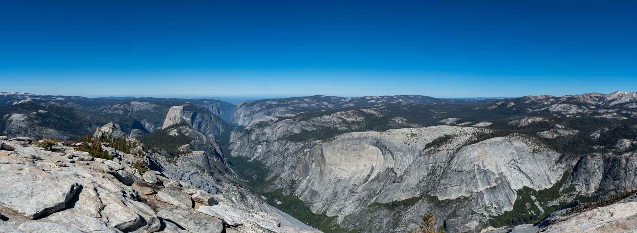
Cloud’s Rest summit views
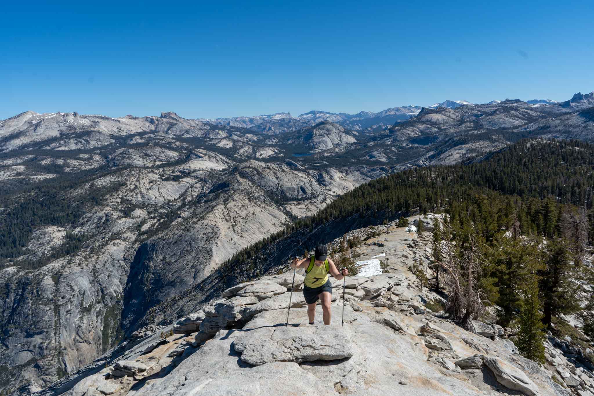
The final ridge heading to the summit of Cloud’s Rest

Tenaya Lake
