


Blame it on the obvious appeal of the ocean, but wilderness beach backpacking offers a blissful combination of adventure in an ever-changing environment and inner meditation that you won’t find anywhere else. Nothing compares to millions of small pebbles massaging your bare feet along the coastline, the moment your daily thoughts drift away with the mist of a salty breeze and the sound of crashing waves, or the endless galaxy of stars above that entertains you at night. See for yourself on these three trails along the Pacific Northwest coastline.
Pros: Massive sandy beaches, lush greenery and forests, rocky headlands
Cons: Extremely popular, late summer fresh water sources can be tricky to find in certain camps
This introduction to beach backpacking has all the key elements: miles of sand to navigate, raging surf, glorious big trees and head-spinning views of rocky headlands. Plan ahead: getting camping permits for peak summertime is pretty tough here. Access this route from the Ozette trailhead, a short, forested section mostly on boardwalk. The sound of lapping waves along the shoreline will welcome you as you trek closer to the Cape Alava campsite.
You will need routefinding skills given the potential of ocean fog shrouding your way. Perhaps an even more important skill is the ability to understand and read tides, so you don’t become trapped by incoming higher water levels as you head north for 15 miles one way to the next campsite at Shi Shi Beach. Here you’ll find mostly open beach hiking, with a few access routes that you will climb using the installed ropes to help you reach the headland sections to avoid incoming tides or navigate around rocky outcrops pounded by surf. Time your arrival at Camp Alava around sunset because it has an amazing westward-facing vantage point. Tip: Cross the Ozette River at low tide.
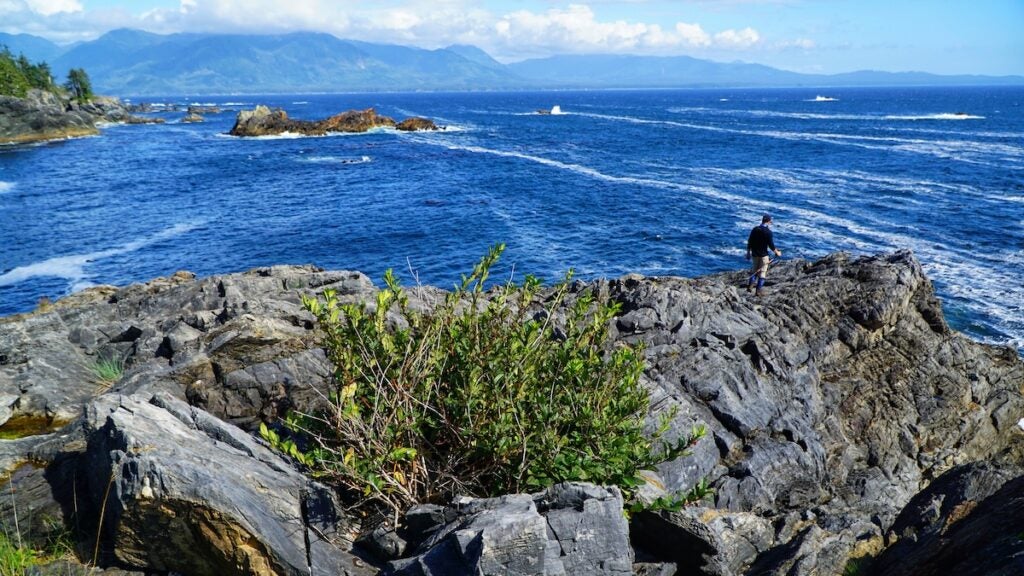
Pros: First Nation history, long stretches of beach, forests and lighthouses
Cons: Hard to get camping permit, some busy campsites
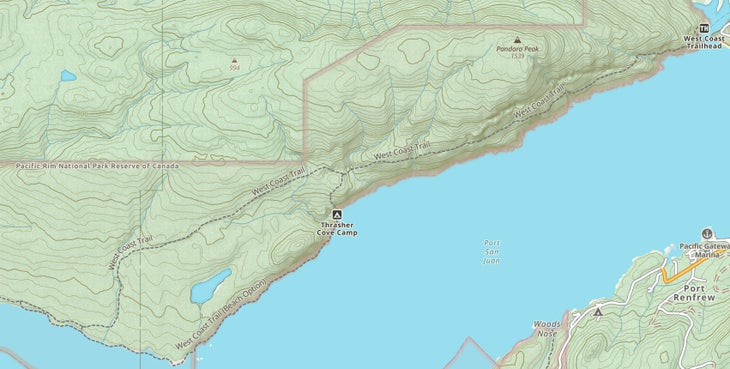
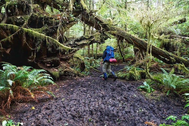
Does trudging through mud pits, getting pounded by rainstorms, and climbing ladders with a 50-pound bag on your back sound like a good time to you? Then consider leveling up on the West Coast Trail, a long-standing favorite of beach backpacking enthusiasts. This 47-mile trail was constructed in 1907 for rescue crews because the rugged coastline scuttled so many ships. There are many reasons to go—historic lighthouses, massive rock headlands, majestic forests, and miles of sandy beaches—but extra special is meeting the West Coast Trail Guardians, members of local First Nations who maintain the trail and share Indigenous history of the area, info on the local flora and fauna, and how both helped them live off the land for thousands of years. Most hikers choose to start from Bamfield, which provides an easier grade and mostly beach and forested sections. On average, it takes 6 to 8 days to complete this trail, and the second half is tougher than the first (if starting from Bamfield). As you hike toward the endpoint at Port Renfrew, you’ll encounter more challenging above-ground ladders, more rugged sections of rocky coastline, and miles of knee-deep, rooty mud.
Pros: Remote and wild with plenty of First Nations history and culture
Cons: A bit more cost for access- but the access is part of the adventure
Located on its namesake Nootka Island off the west coast of Vancouver Island, the roughly 22-mile-long Nootka Trail is a untamed adventure that combines long, dreamy stretches of deserted beach, giant forests, waterfall-side campsites, and spellbinding views of the north Pacific. The first crux is getting there: You’ll either take a flight with Air Nootka Seaplanes or board a boat—coastal freighters, water taxis, and the minesweeper-turned-cruiser MV Uchuck III all take you to the island. From there, it’s time to walk and absorb the history and culture of the Mowachaht-Muchalaht First Nation along the way, especially in the village of Yuquot. (Note that you’ll need a $50 permit to hike the trail.
Hiking the Pacific Northwest’s beaches takes a few specialized skills. First, learn how to read tide charts. Each of these routes involves sections that potentially navigate around rocky headlands, and getting caught trying to traverse them when the tide is coming in could leave you in danger of getting stranded or worse. Schedule your daily mileage around when you’ll hit water sources and what their tide levels will be. Plan river crossings at low tide, as this is the time of lowest water depth. Check freshwater options when choosing camping sites and make sure you are not drinking saltwater. Source water above the tidal influenced zones. Bring high-quality rain gear and due to incredible amounts of mud you might encounter, including hiking boots that fit well to decrease your chance of blisters due to extreme wetness.
From 2024
